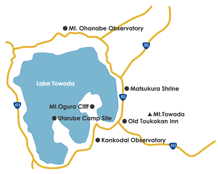
02.Utarube Area with Nature, History and Gourmet Lake Towada Leisure Area
Introduction of This Area
It is located in the middle of the Ysumiya and Nenokuchi, and developed in the eastern inlet of the Ogura Peninsula, the Higashi Lake, and the Utarube River.
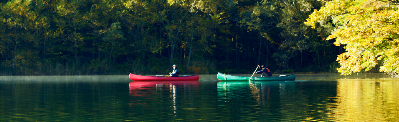
Full of activities where you can come in contact with nature, such as trekking, camping and canoeing. The nature seen from a distance is good, but the nature you feel when you sit is even more wonderful. In addition to spring, summer and autumn, walking in the winter while following the footprints of animals left in the snow is a valuable experience that can only be enjoyed in winter.
A shrine where legends dwell, and a cliff made of volcanoes are highlights of Lake Towada’s history.
If you enjoy exploring around, it is recommended that you relax at a guesthouse with a meal that focuses on locally grown Japanese trout and wild plants.
-
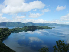
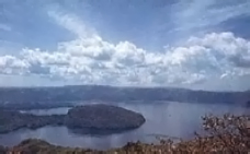
Kankodai Observatory(Altitude 583m)
It is located between the Utarube and Ysumiya, at the mountain pass of National Route 103, on the cliff facing Lake Nakakoumi.
The Senjou-maku, Goshiki-iwa of the Ogura peninsula, Byoubu-iwa of Nakayama peninsula shine in the deepest lake, and the scenic view of the white pleasure boats that come and go. -
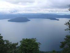
Mt.Ohanabe Observatory(Altitude 1011m)
From Nenokuchi, take National Route 102 toward Hirosaki, and climb up the 7-turn steep hill.
The two peninsulas of Ogura and Nakayama protrude like the lake surface of the azure, and you can see the mysterious Lake Towada in the background. -
Mt.Towada(Altitude 1054m)
You can reach the top of the mountain in about 2 hours and 30mins on foot from the Utarube Mountain Trail. From the top, you can see Lake Towada like a miniature garden, with the Hakkoda mountain range, Mt. Iwaki, Mt.
Hachimantai, Mt. Iwate, and Mt.Towada with a magnificent 360-degree view.
Near the top is a yew forest that is shorter than the height of a person, and it is a stunning tree similar to a bonsai tree. -
Mt.Ogura Cliff
Lake Towada is a double caldera lake formed by volcanoes. The cliffs of Mt. Ogura seen from Utarube were formed by lava after the great eruption of Mt. Ogura. These cliffs are part of the lava dome.
The name “Sarugakura” is from the Ainu language meaning “even monkeys cannot climb”, but now that name is forgotten…
It is a place reminiscent of the power of volcanic activity unique to Lake Towada. -
Matsukura Shrine
Matsukura Shrine is where you can see a red torii gate and a small shrine on the lake shore on the way from Nenokuchi to Utarube.
ーA woman named Matsuko, who adored Nansobo long ago, came to Matsukura following the Nansobo who went out for training. She built a coffin hut, and waited for Nansobo for years. She heard a rumor that he became a lord of the lake and she threw herself into the lake.
Later, a rock shaped like a female body appeared there. There is also a legend that people pitied Matsuko and made a small shrine there. -
Utarube Camp Site
This is the best campsite where you can enjoy the nature of Towada Lake, which is surrounded by broad-leaved forests.
The sunset from the pier is superb. The sunset that dyes Lake Towada is a beauty that cannot be described in words, a must-see for photographers.
Winter is a wild bird paradise.
Download the map
download >